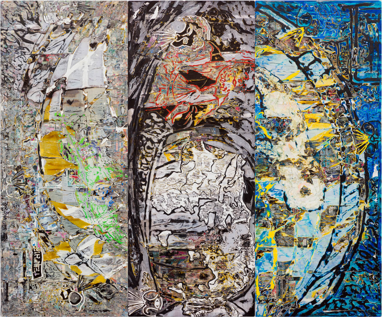
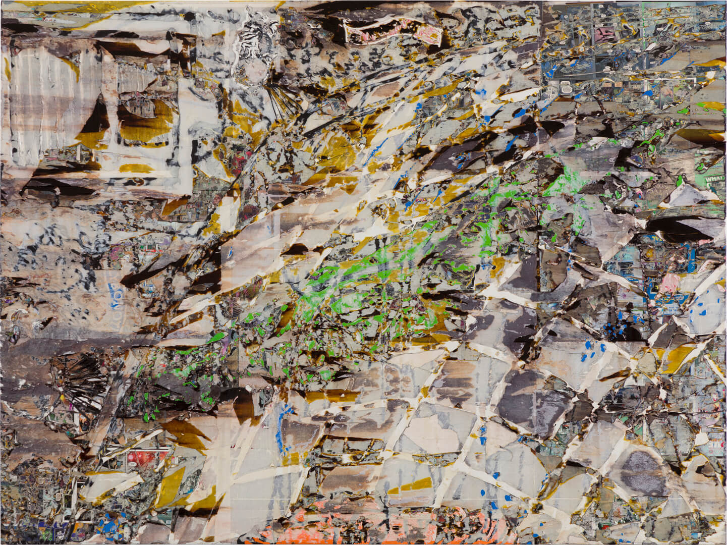
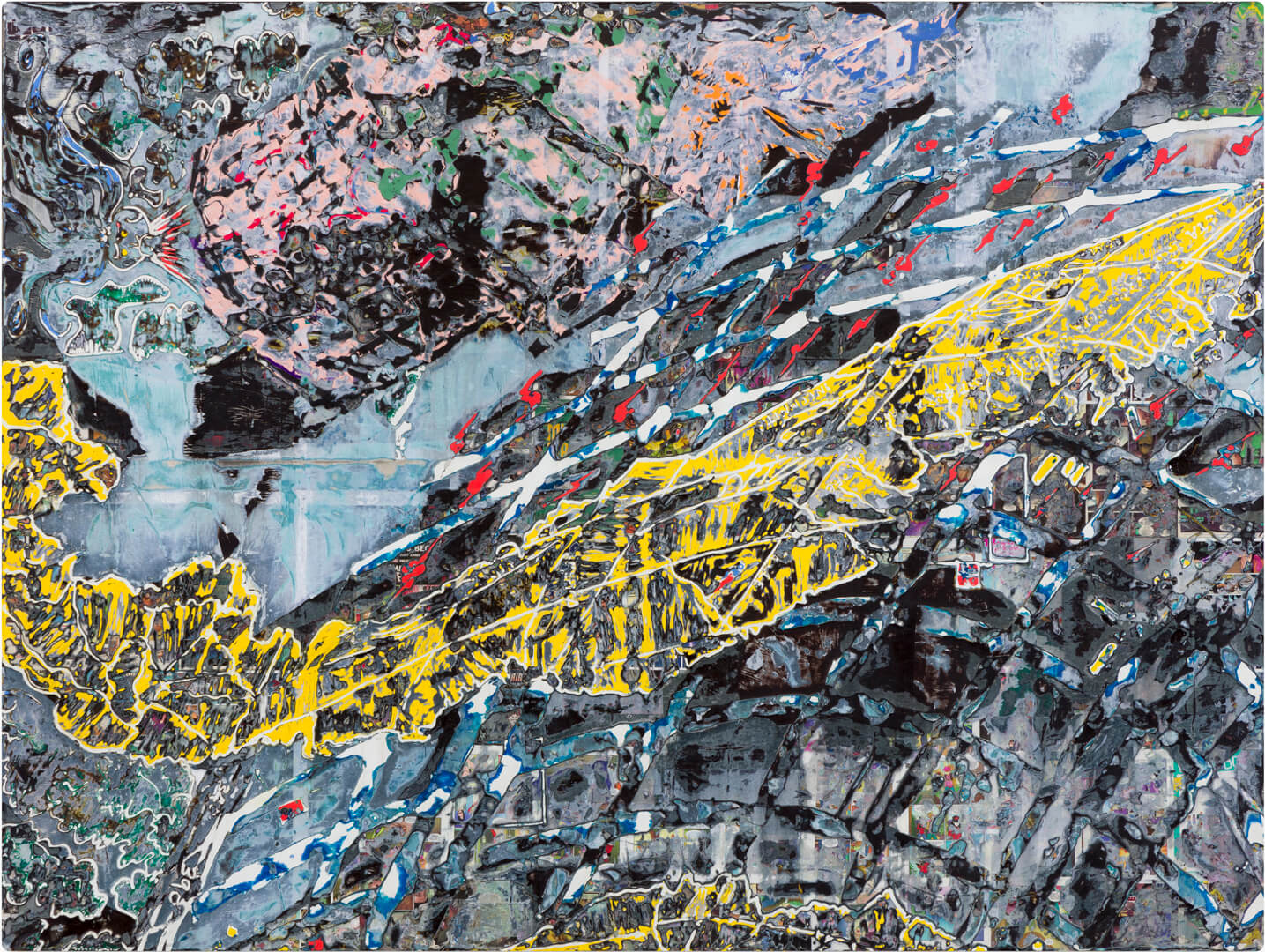
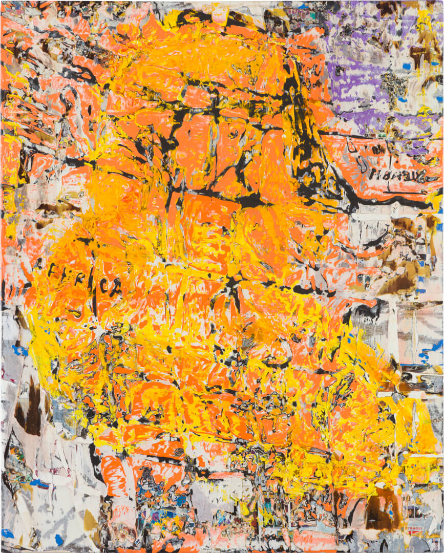
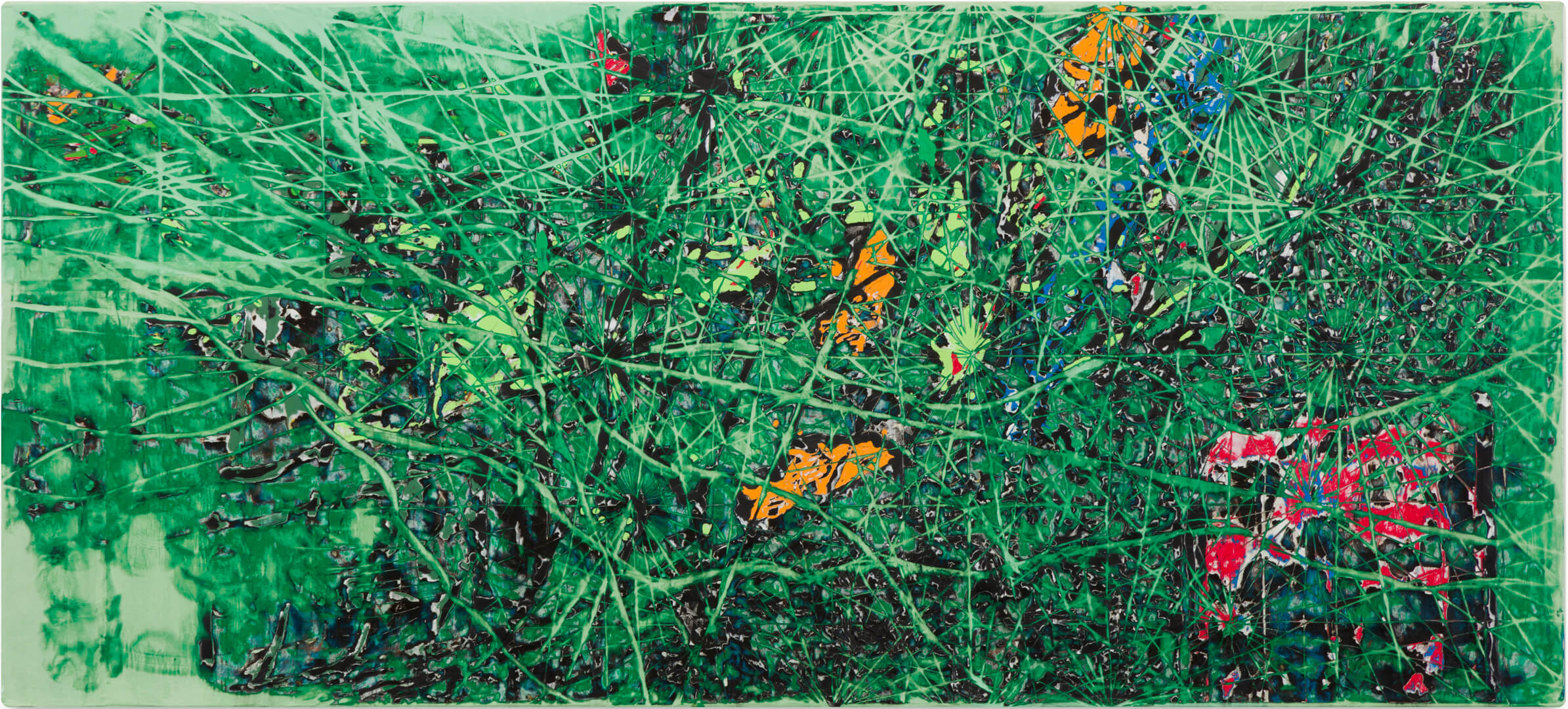
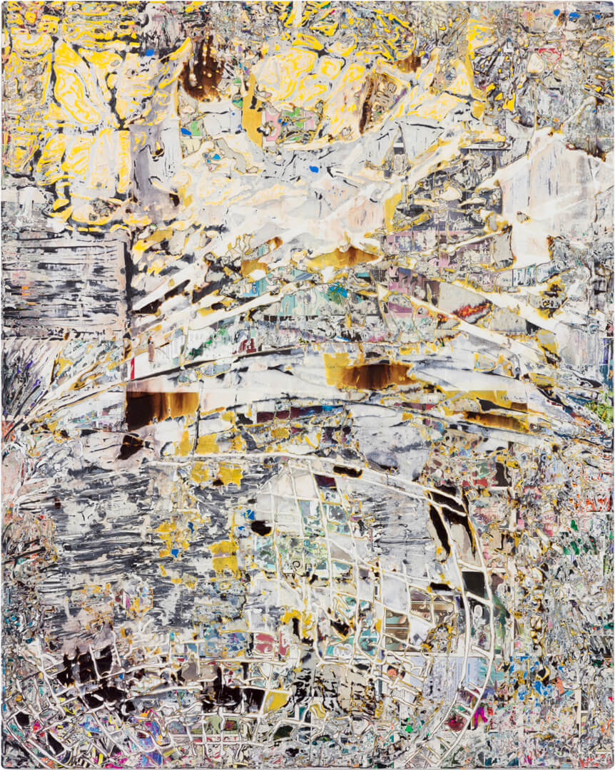
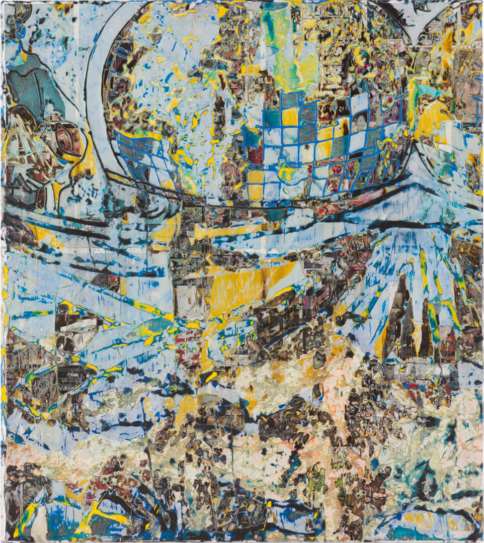
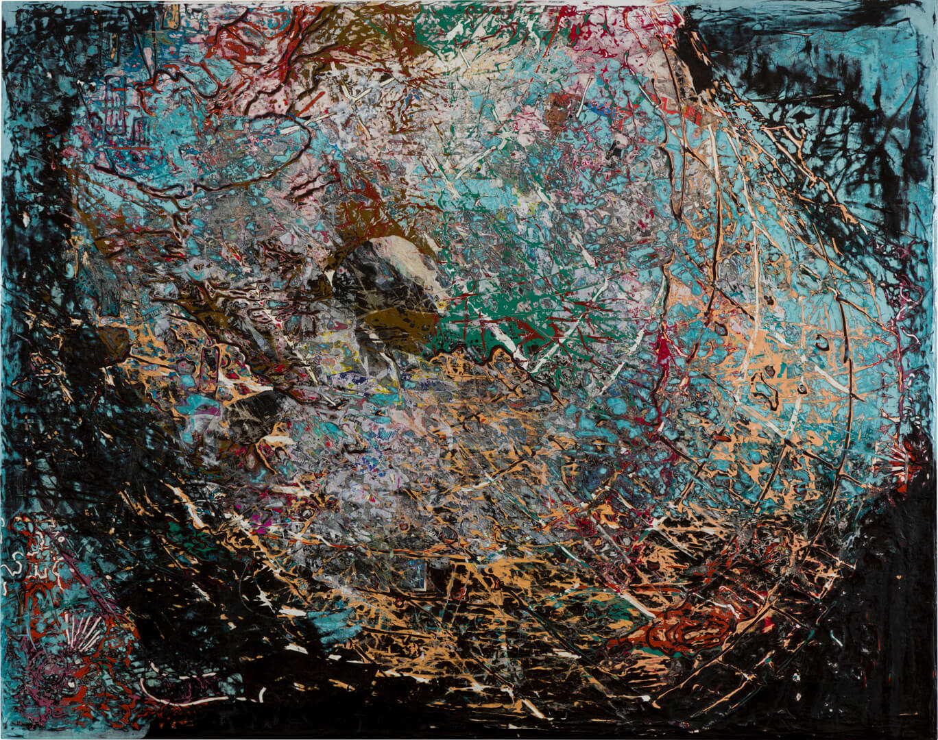
‘Maps have always been shady. So much of what we understand about landmasses comes from cartographers and their relationships to power, and the need to always keep a place for Europe at the center of history. I’m interested in the potential for abstraction to pull the stories from the margins onto the pages of that history.’—Mark Bradford
In the original Waldseemüller map from 1507, Europe, the Mediterranean Sea, the northern coast of Africa, and the Middle East are well-defined and recognizable to the modern eye. Approaching the edges, angular shapes represent masses of land without definition, unexplored regions yet to be drawn and divided by European colonial powers. Latin texts, illustrations of human figures, and angelic personifications of trade winds fill the margins lending fantastical overtones to the depiction of the world. Across the Atlantic Ocean, ‘America’ is printed over what would later become known as Brazil.
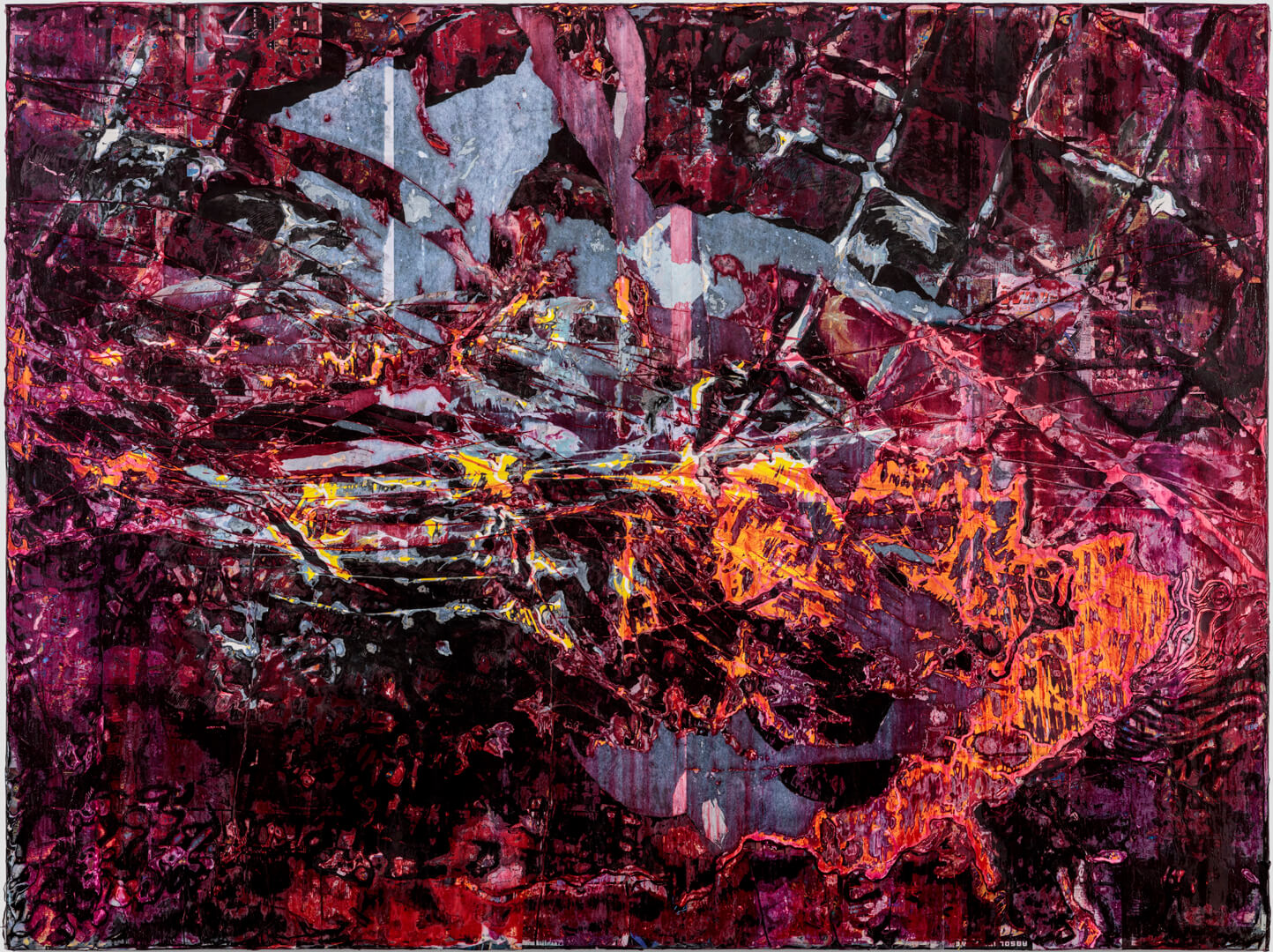
Beginning with fragments of this map, Bradford applied caulk in expressive gestures that drip and run across the surface. Various types of paper add layers of color, and bleach transforms the materials into a nuance of shades and textures.
Read more +
The artist then processed the surfaces using his signature techniques of sanding, scraping, tearing, and gouging through the accumulated layers of materials, excavating fossilized mythologies that feel familiar yet unrecognizable. Markings reminiscent of scrimshawed bones, vast interconnected lines, and half-recognizable shapes and figures repeat across the canvases in various placements and orientations.
The visual language evokes multiple narratives that conjure images of a world in motion: continental drift, animal migrations, the trans-Atlantic slave trade, or the displacement of indigenous peoples. Below the layers of accumulated material, Bradford uncovers unstable narratives of European exploration rooted in myth. Neglected on the surface of this map are the stories of those adversely impacted by the legacy of these colonial histories.


 Scan the image to begin